|
||
|
|
|||
|
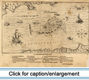
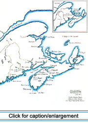
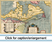
The date of the arrival of the first Europeans in the Micmac homeland is unknown. Throughout the 16th century, hundreds of small fishing vessels came to the coast of Newfoundland and to the Gulf of St. Lawrence in search of cod. They not only fished offshore, but gradually established fishing stations where they cured their catch (Clark 1968: 75). Consequently, the northeast coast of North America was well known in the seaports of France, Spain, the Basque country, Portugal, and West Country England long before the founding of the colony of Acadia in "New France." French claim to lands in North America date from three voyages of Jacques Cartier (1534-1542), particularly the raising of a cross with the royal arms on the Gaspé peninsula in 1534 (McInnis 1969: 20). There are two theories regarding the origin of the name "Acadie" or "Acadia." One attributes it to the explorer Verrazano, who in 1524 named the coastline of the present-day Middle Atlantic states "Arcadie," in remembrance of a land of beauty and innocence celebrated in classical Greek poetry. The name "Arcadie" (with an "r") appears on various 16th-century maps of the east coast of North America, and has been accepted by many historians as being the origin of the name "Acadie." The romantic associations of the term "Arcadie" likely explain why this theory has been widely published and is even found in recent scholarly works (Daigle 1982). The more plausible theory is that "Acadie" derives from a Micmac word rendered in French as "cadie," meaning a piece of land, generally with a favorable connotation (Clark 1968: 71). The word "-cadie" is found in many present-day place names such as Tracadie and Shubenacadie in the Canadian Maritimes, and Passamaquoddy, an English corruption of Passamacadie. Virtually all French references to Acadia from the time of the first significant contacts with the Micmacs use the form without the "r", "Acadie." The cartographic use of "Arcadie" for various parts of the coast of eastern North America may have prepared the way for the acceptance of "-cadie" from its Micmac source (Clark 1968: 71). |
|||
 |
The conflict between the British and the French over St. Sauveur and Port-Royal was merely one of a long series of encounters. As Daigle (1982b: 24) has observed, "Acadia, within the colonial context of North America, was a border colony. Positioned between the two rival settlements (New France in the north and New England in the south), the area around the Bay of Fundy was repeatedly the subject of dispute and the scene of military engagements." There has been much speculation as to the possible origins in France of the founding families of Acadia. Since the publication of Les parlers français d'Acadie--Enquéte linguistique (Massignon 1962), most authors have accepted the hypothesis that a great number of families were drawn from Charles D'Aulnay's estate at La Chaussé near Loudun in the province of Poitou. D'Aulnay had recruited families for colonization as lieutenant general of Acadia. While it does seem likely that a sizable proportion of Acadia's 17th-century immigrants were natives of the western provinces of Poitou, Aunis, Angoumois, and Saintonge, recent research also indicates that many came from the northern provinces (D'Entremont 1991: 128-143). They were therefore not a homogeneous group at the outset. At the time of the first census of Acadia in 1671, the population of
the colony was reported to be 392, and may have been slightly greater
(Roy 1982: 134-135). The number rose by 2,500 by 1714, less than 50 years
later. From the first seat of population at Port-Royal, In 1654 British forces seized Port-Royal and held Acadia for the next 13 years, until France regained the territory by treaty. Port-Royal fell to the British for the final time in 1710, and Acadia became a permanent British possession as a result of the 1713 Treaty of Utrecht. As the colony had no fixed boundaries, the French developed a strategy aimed at giving up as little territory as possible. They claimed Acadia consisted only of what is now peninsular Nova Scotia, and they began to erect fortifications on Ile Royale (Cape Breton Island), Ile Saint-Jean (Prince Edward Island), and in present-day New Brunswick. The British established a military government at Port-Royal, which they renamed Annapolis Royal. Rather than putting the Acadians under military rule, they established a system of representation by delegates, where any request from British officials at Annapolis Royal was transmitted to the inhabitants through men chosen by their villages as representatives (Griffiths 1992: 40-41). Following the Treaty of Utrecht the Acadians enjoyed a 30-year period
of peace, the longest since the founding of the colony. Due to a very
high birth rate and a low death rate, the population rose to over 10,000
by the late 1740s (Roy 1982: 134). The renewal of hostilities between
the British and French in 1744 marked the end of what has been called
the "golden age" of Acadia. While the war of the Peace was restored by treaty in 1748, but life did not return to normal for the Acadians. Both the British and French increased their military presence in the area, the former establishing the fortified town of Halifax, and the latter founding Forts Beauséjour and Gaspereau in what is now New Brunswick. The Governor of Massachusetts was infuriated when the fortress of Louisbourg was restored to the French as the outcome of the peace negotiations. The rich farmlands of the Bay of Fundy area had long been coveted by the New Englanders who wished to expand their settlements to the north. The British colonial administrators in London, wishing to appease the New Englanders, changed their policy toward Acadians and began to insist upon the latter signing an unconditional oath of loyalty. Some Acadians responded by moving from Nova Scotia into territories held by the French, but the majority remained in their original settlements, maintaining that the conditional oaths they had signed earlier were still valid. The renewal of hostilities in 1754 hastened the end of the standoff. What followed was the tragic deportation that effectively destroyed Acadian society as it had existed until then. |
||

|
|||